A Cartload of Cartography 1: Ancient & Medieval Maps
By Tar-Palantir
Right, so you've worked out how your world should look based on sensible principles of earth and planetary science, so you don't have things such as your rivers flowing uphill or your mountains forming tessellating hexagons. But, how do you actually design the map?
 Fig 1. An idealised T-O type map.
Maps from Antiquity and the early Medieval age are very rarely maps in the way we think of them. From the 6th century through to the High Middle Ages, the main driving force behind the production of maps in Europe was the Church. As such, the point of a map was to show the world in a way that supported Christian theology and teaching. The actual geography was a rather secondary aspect. This of course makes good sense – in an age when most of the population were illiterate, having a big picture that showed a lot of Biblical stories was an invaluable teaching aid.  Fig 2. Part of 'Tabula Peutingeriana'
You might therefore ask: how did anyone get anywhere? Long-distance pilgrimages were often made in this age, and travellers had to know where to go. The answer is something called an itinerarium (Figure 2) or a periplus. These weren't pictorial maps, but lists of towns (the itinerarium) or harbours and landmarks (the periplus) between two points, in order, with distances, so travellers knew where they had to get to next. Essentially, they were linear route maps, and the better kind would provide a schematic of the route as a straight-ish line, as well as information on things such as water sources and way-stations. What they did not include was any notion of topography or of a 3D space.
 Fig 3. The Hereford Mappa Mundi
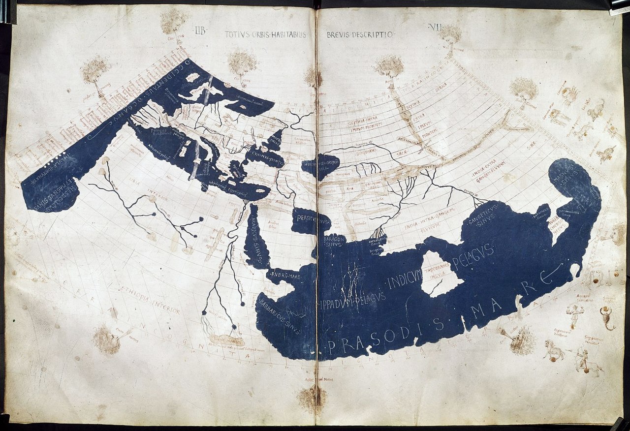
Fig 4. A 15th century version of Ptolemy's world map.
To sum all this up: if you're going for an early-style, large-scale map, think how it might interact with and depict the legends, religion and history of your world and about how much of that world your supposed source might actually know about in any kind of detail. Or, if there's a particular part of it you want to highlight, drawing up an itinerarium and/or periplus for what might be a common journey through it could be a good idea. Stay tuned for part 2, when I'll move on to talk about the Renaissance and beyond...
0 comments | Write Comment